TSX-V: SCLT US: SCLTF GOLD COPPER URANIUM TSX-V: SCLT US: SCLTF GOLD COPPER

Project for Option

Duddridge Lake

Historic NI43-101 inferred resource estimate of 227,880 tonnes with a grade of 2.14 lbs/tonne U3O8 , completed by Fission Energy Corporation in 2007.

HIGHLIGHTS

Historic Resource Estimate

Historic NI43-101 inferred resource estimate of 227,880 tonnes with a grade of 2.14 lbs/tonne U3O8 , completed by Fission Energy Corporation in 2007.

High-Grade Historic Boulder Assays

Assays of 9.8% U3O8 , 1.6% Cu, 0.2% V, 0.2 oz/ton Au and 7.0 oz/ton Ag in historic boulder samples (SMDI 0700a)

Site Access & Infrastructure

Permanent road access 12 km from property, then all-weather track to deposit.

Exploration Work Completed

Approximately 50 DDH to date, geophysics and soil sampling including MMI

Untested Depth & Strike Potential

Potential along strike and at depth; past drilling less than 100 m below surface.

Best Drill Intercepts

Best historic drill intersection was in 2 drill holes, 200 ft (61.0 m) apart, which cut a zone averaging 2.7 lb/ton U3O8 over 26 ft (7.9 m). (SMDI 0700a)

Duddridge Lake

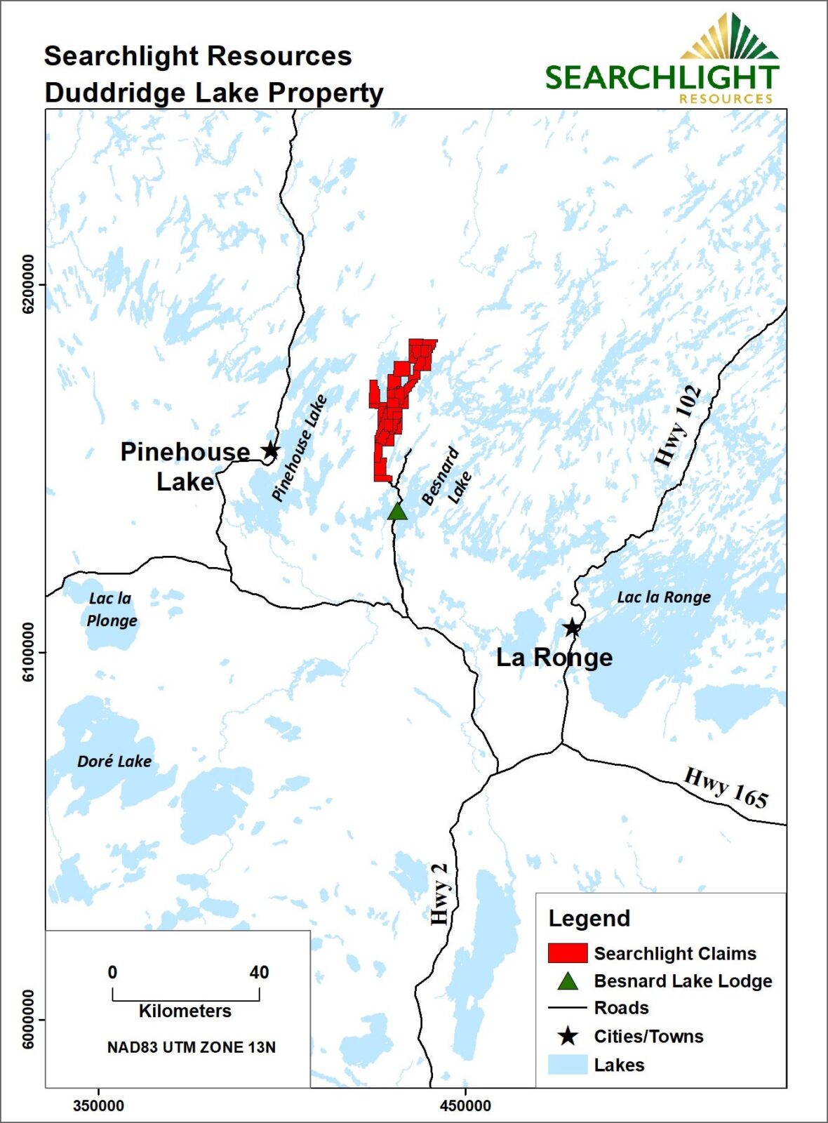
Location and Access

  • Permanent road access to 12 km from deposit, then all-weather track to deposit.
  • Approximately 180 km from La Ronge by road
  • Approximately 20 km to lodges and campgrounds for accommodation

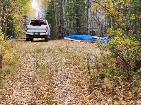
Track to Duddridge Lake Deposit

Total of 10 claims covering 79.85 sq km

Historic Exploration

Text box to be filled after going live

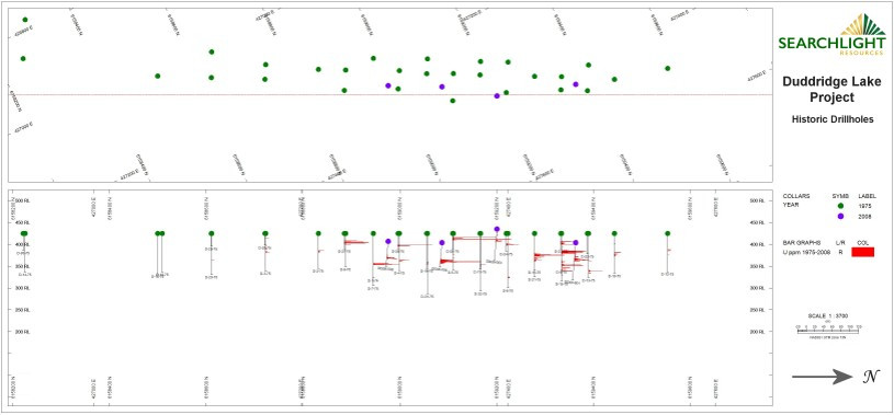
Known deposit is shallow

Historic Exploration

Duddridge Lake Uranium Deposit Long Section

Historic Exploration

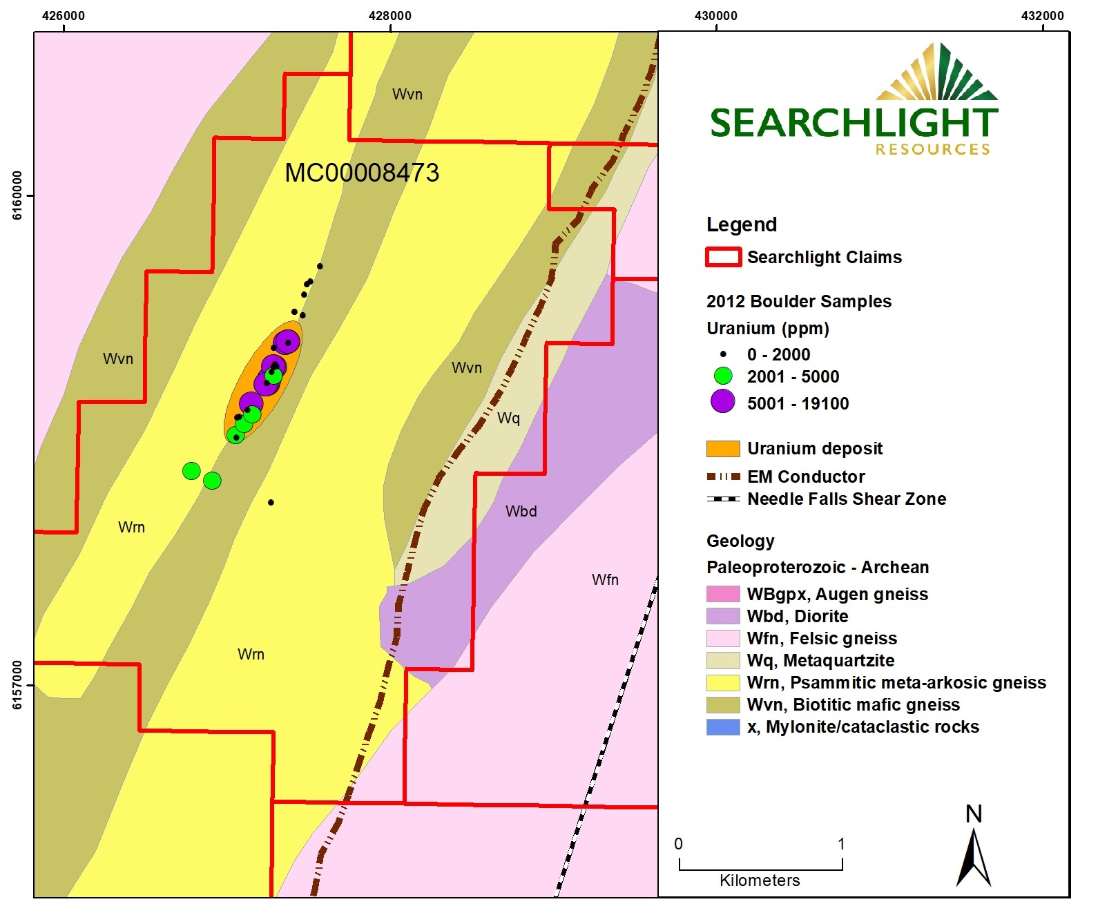
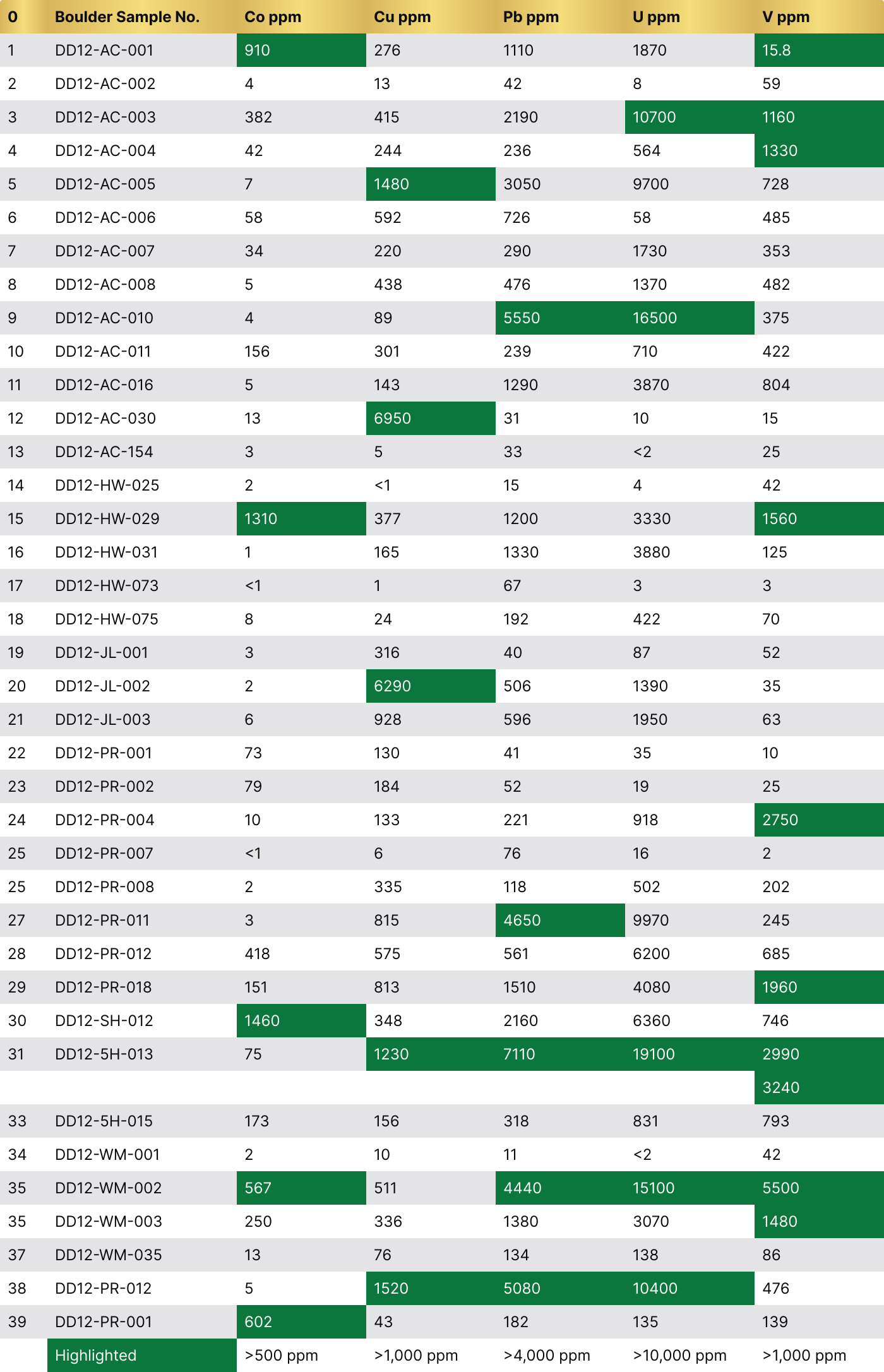
Fission 2012 Boulder Samples

Significant values of

1.910 %

Uranium

0.695 %

Copper

0.550 %

Vanadium

0.146 %

Cobalt

0.711 %

Lead

0Boulder Sample No.Co ppmCu ppmPb ppmU ppmV ppm
1DD12-AC-0019102761110187015.8
2DD12-AC-00241342859
3DD12-AC-0033824152190107001160
4DD12-AC-004422442365641330
5DD12-AC-0057148030509700728
6DD12-AC-0065859272658485
7DD12-AC-007342202901730353
8DD12-AC-00854384761370482
9DD12-AC-010489555016500375
10DD12-AC-011156301239710422
11DD12-AC-016514312903870804
12DD12-AC-030136950311015
13DD12-AC-1543533<225
14DD12-HW-0252<115442
15DD12-HW-0291310377120033301560
16DD12-HW-031116513303880125
17DD12-HW-073<116733
18DD12-HW-07582419242270
19DD12-JL-0013316408752
20DD12-JL-00226290506139035
21DD12-JL-0036928596195063
22DD12-PR-00173130413510
23DD12-PR-00279184521925
24DD12-PR-004101332219182750
25DD12-PR-007<1676162
25DD12-PR-0083335118502202
27DD12-PR-011381546509970245
28DD12-PR-0124185755616200685
29DD12-PR-018151813151040801960
30DD12-SH-012146034821606360746
31DD12-5H-0137512307110191002990
3240
33DD12-5H-015173156318831793
34DD12-WM-00121011<242
35DD12-WM-0025675114440151005500
35DD12-WM-003250336138030701480
37DD12-WM-035137613413886
38DD12-PR-01251520508010400476
39DD12-PR-00160243182135139
Highlighted>500 ppm>1,000 ppm>4,000 ppm>10,000 ppm>1,000 ppm

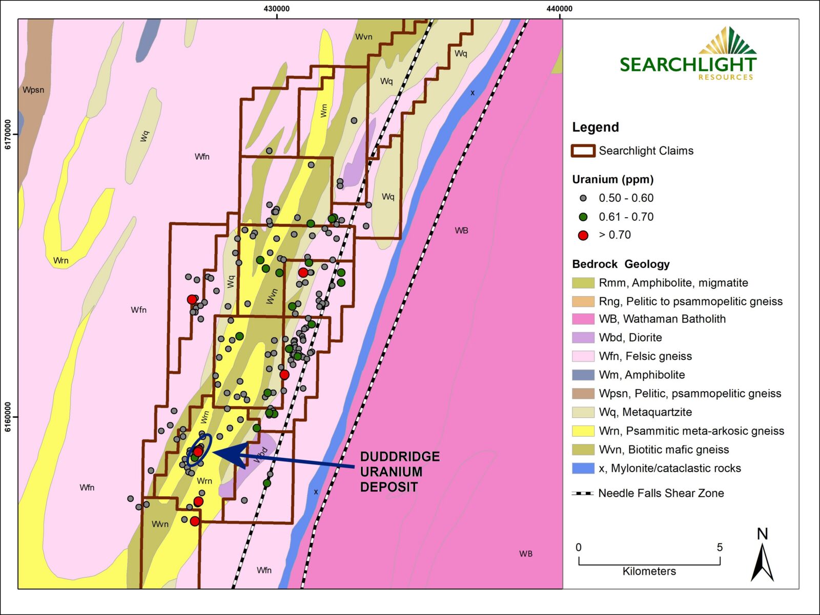
Searchlight Resources Exploration Airborne Radiometric Survey

Airborne Radiometric survey &

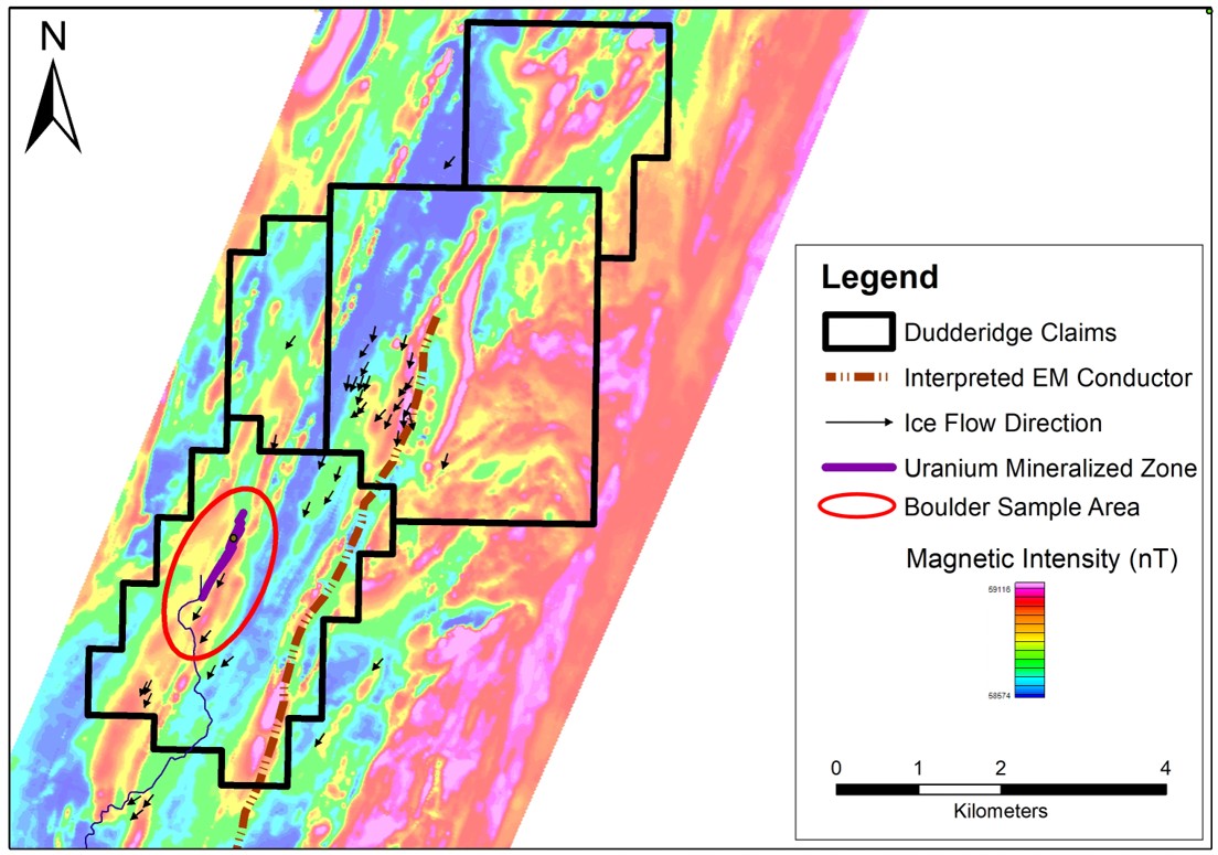
Regional Geology over Duddridge Lake claims

Highlights the known Duddridge uranium deposit

Shows potential targets along geological strike from deposit.

Mineralization is associated with carbonaceous meta-arkose which occurs as irregular lenses within a hematitic arkose

Multiple high-grade boulders containing, U, Cu, Co & V on surface near the deposit and along strike.

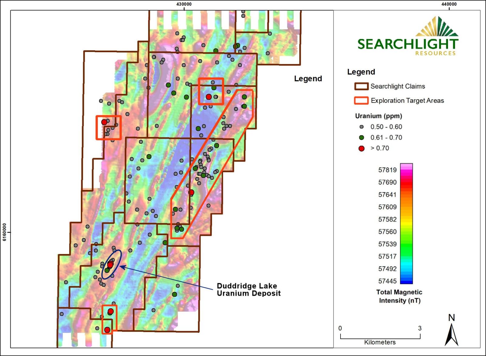
Searchlight Resources Exploration Airborne Radiometric Survey

Airborne Radiometric survey &

Magnetic Survey’s over Duddridge Lake claims

Radiometrics highlight the known Duddridge uranium deposit

Magnetics shows exploration potential along strike from deposit

Shows exploration potential parallel east of deposit

Radiometric survey penetrates less than a metre through overburden so limited in areas of continuous overburden

Searchlight Resources Exploration 

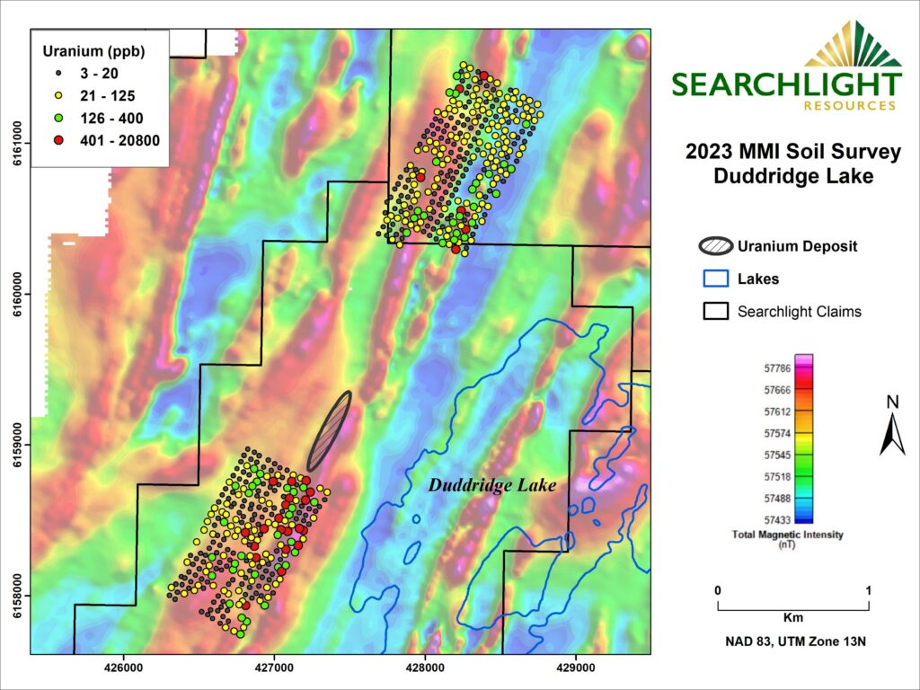
MMI Survey

MMI

Mobile Metal Ion

  • 2023 survey Xxx samples
  • Highlighting multiple uranium targets along strike from the Duddridge Lake deposit
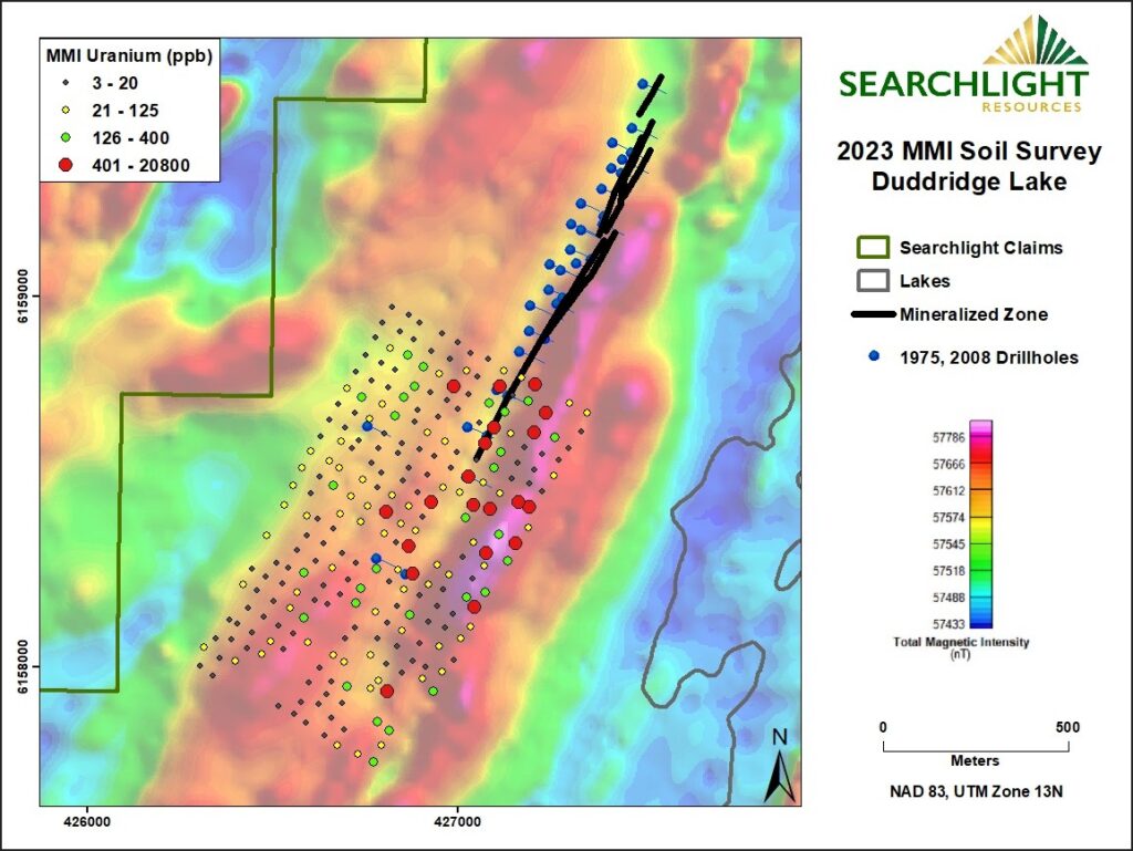
  • Known mineralized zone is located on western side of magnetic high.

Mobile Metal Ion (MMI)

is an advanced geochemical soil sampling technique used in mineral exploration to find deeply buried ore deposits. It measures loosely bound metal ions that have migrated upward from subsurface mineralization into surface soils, using weak chemical extractants and high-precision ICP-MS analysis.

Searchlight Resources Exploration 

MMI Survey

Mobile Metal Ion (MMI)

South Grid

  • South of the mineralized zone both the Mag and MMI results shift to the east.

  • Outlines possible parallel zone

Known deposit is shallow with only an 80 metres depth leaving significant potential under known deposit.

Drill targets north and south along strike of known deposit.

MMI and Mag survey both a shift to east

Conduct IP survey along strike to tie all known data together.

Continue MMI surveys along strike.