slide_1 (1)

WAPAWEKKA COPPER – VMS PROJECT

Available for option

Summary

The Wapawekka Copper VMS project covers 104.1 square kilometres of the underexplored Wapawekka Greenstone Belt, with potential for multiple copper-VMS and gold targets. Acquired in 2025 by staking the six claims are held 100% by Searchlight Resources.

Project Highlights

  • 24 high priority Copper VMS drill targets outline b in house interpretation
  • Excellent geology highly prospective for VMS and gold mineralization
  • District scale project of underexplored Greenstone Belt.
  • Located in the southern

Future Exploration

  • Ground Electromagnetic Surveys.
  • Drilling 24 high priority Copper VMS drill targets.

Claims and Location

  • Six claims covering 104.1 square kilometres.
  • 40 km north of highway 106
  • 75 km from McIlvenna Bay Mine
  • 125 km west of from Flin Flon 777 Mine in Flin Flon
  • 350 km north of Saskatoon


wapawekka-aug_2024_claim_map_002.1050x0-is

Wapawekka Location Map

Map of Wapawekka Drill Targets

Geology

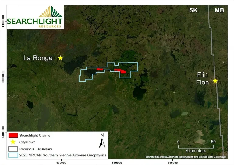
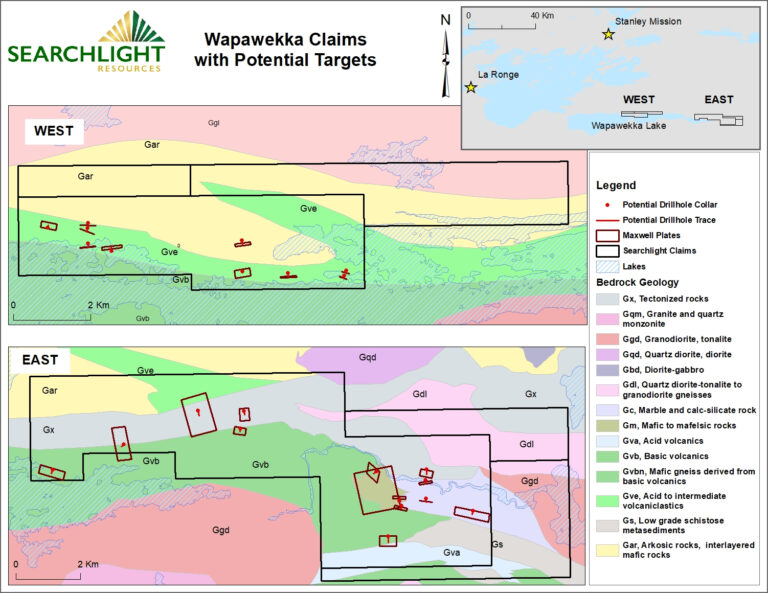
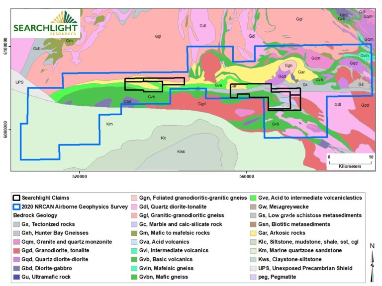
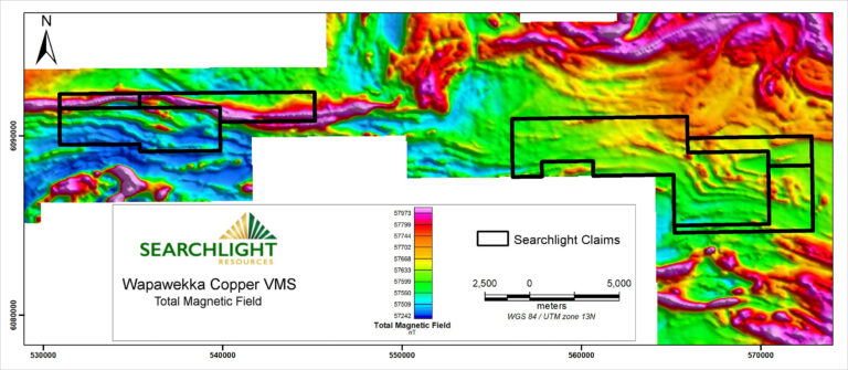
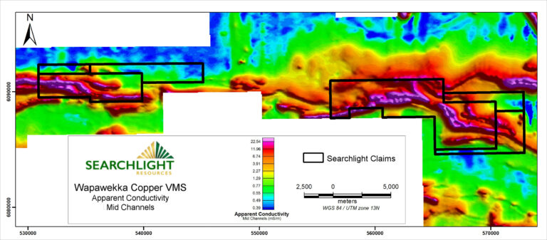
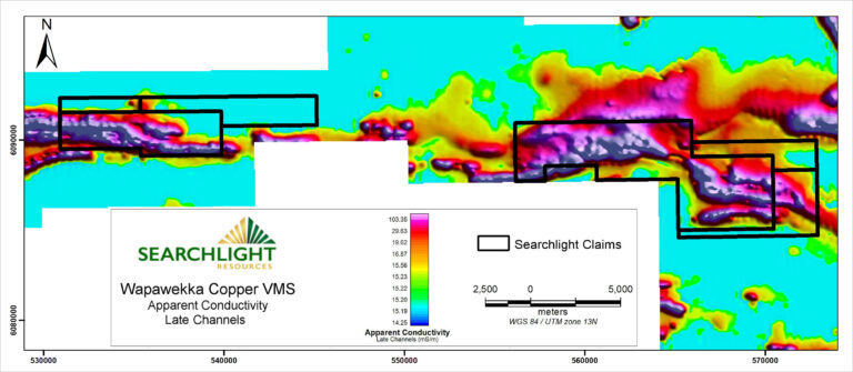
The Wapawekka Lake Greenstone Belt is an underexplored Precambrian geological region located approximately 40 to 70 kilometres southeast of La Ronge, Saskatchewan.

The area is considered highly prospective for:

Base Metals (VMS): Specifically targeting Volcanogenic Massive Sulphide deposits.Gold: 

Historic and recent interest in gold mineralization.

Battery Metals: Potential for Nickel and other metals associated with mafic-ultramafic rocks.

Map of Wapawekka Regional Geology

Geophysics

Staking and target interpretation is based on high quality 2020 Airborne Mag and EM survey by Federal and Provincial governments and inhouse geophysical interpretation.

The Southern Glennie airborne electromagnetic and magnetic surveys were flown over an area southeast of Lac La Ronge, Saskatchewan. The surveys covered an area of 1,110 sq. km, with a total of 6,595 line-kilometres at 200-metre line spacing. The surveys were funded by the Government of Saskatchewan as part of its Mineral Development Strategy, with technical support provided by Natural Resources Canada. The Government of Saskatchewan released the raw data and a set of maps on September 17th, 2020.

Southern Glennie Airborne Total Magnetic Field

Southern Glennie Airborne Apparent Conductivity Mid Channels

Southern Glennie Airborne Apparent Conductivity Late Channels

24 high priority Copper VMS drill-ready targets, outlined by Searchlight

Scroll to Top